Click on the image above to see a larger version.
Gardening in New York - How to Use the New York USDA Plant Hardiness Map
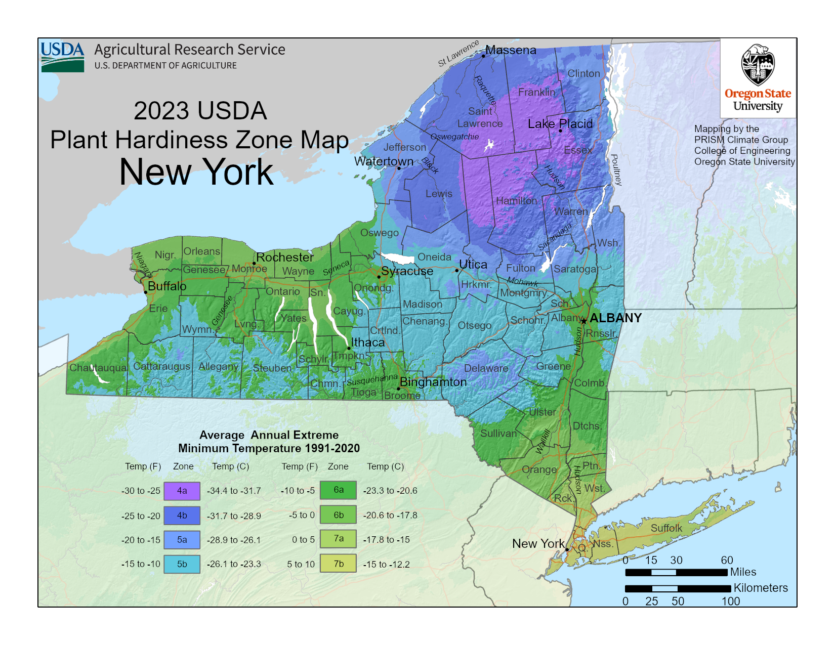
The USDA began producing plant hardiness maps in 1960 and has been improving its accurateness ever since. In 2023, a new zone hardiness map was released that took the place of the previous 2012 map. The new map includes 8 zones. Above is the New York planting map that indicates the planting regions specific to the state of New York.
There is a 10-degree difference between each planting zone and a 5-degree difference between sub zones.

Gardeners who wish to have a thriving garden should heed the zone data when considering what to plant. Most growers have adopted the plant hardiness information, and this zone information is generally included on the care instructions tag on flowers, shrubs and trees.
According to the USDA map, New York zones include a wide range from 4a to 7b. Those living in zone 4a will not necessarily be able to grow the same plants that can be grown in 7b. Elevation and proximity to large bodies of water play a role in the winter extreme low temperature variance seen on the map.
Although the newest USDA plant hardiness map is more sophisticated than previous versions, it is still not a guarantee. Gardeners should be aware that there are other factors that influence plant hardiness including how and where the plant is placed in the landscape and how it is cared for.
Use the data provided by the hardiness map as a foundation when choosing plants and be sure to do your research before incorporating any flower, shrub or tree into your landscape.
Plant Outside Your Zone with Season Extenders
- If you're growing in cooler zones, these Agfabric floating plant covers from Amazon are an affordable way to trap heat and protect your plants against frost and wind.
- The Ohuhu Portable Mini Greenhouse from Amazon is great for starting seedlings indoors or protecting plants outdoors in cold zones, especially for smaller spaces.
- Cold frames, like the Outsunny Raised Garden Bed Cold Frame from Amazon, are a stylish way to protect your raised beds from frost and rain while trapping in heat.