Click on the image above to see a larger version.
Vermont Gardens and the USDA Plant Map
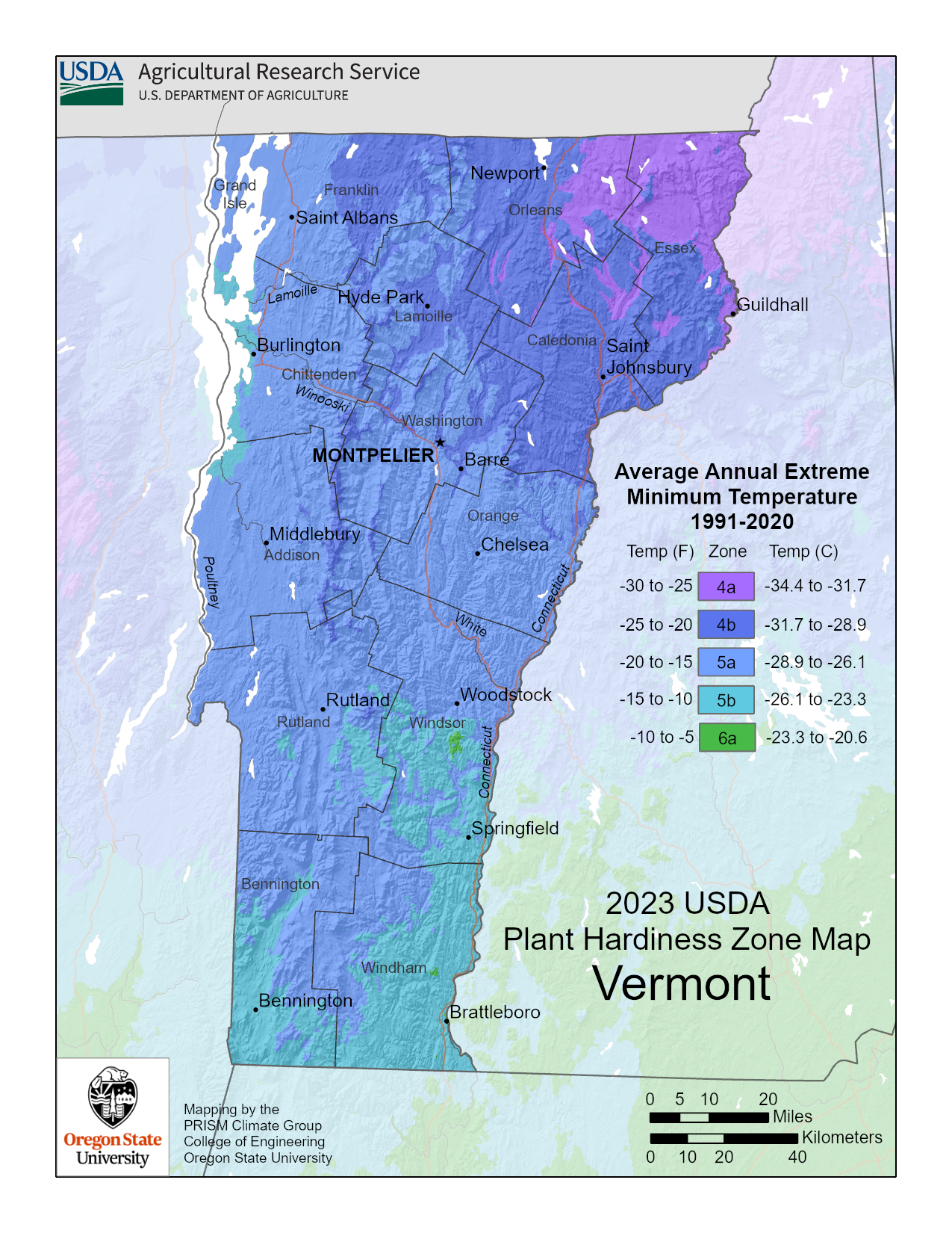
The USDA divides the country into what is called plant hardiness zones. These zones that graduate in 10-degree increments represent the culmination of weather data collected over a thirty-year period. The new map, released at the end of 2023, has changed some zones and taken into consideration factors such as elevation, urban heat, and proximity of an area to a large body of water.
The Vermont planting map, as pictured above, is based on the new data and is a great resource for anyone who loves to garden. Knowing which zone you are in helps tremendously when deciding between plant species that will survive winter low temperatures in your area. You can see an enlarged version of the map by clicking on it.

Vermont zones include a small pocket of 4a with the central section of the state being zones 4b and 5a with the southern section within zone 5b. There are a few pockets of 6a in the southern interior of the state. Much of Vermont has a very short growing season and some cold average extreme winter lows that dip to -30 degrees F. (-34 C.). While many plants, shrubs, and trees will survive and are adapted to this type of extreme weather, it is important to choose only those that are listed for your zone.
Reputable nurseries in your area will only carry plants that are clearly marked with the USDA planting zones that are appropriate for the plant that is for sale. Although the Vermont USDA planting map is an excellent resource for gardeners, it cannot replace proper planting and care that are essential in order for plants to thrive.