Click on the image above to see a larger version.
Ohio Gardening - About the USDA Plant Hardiness Map
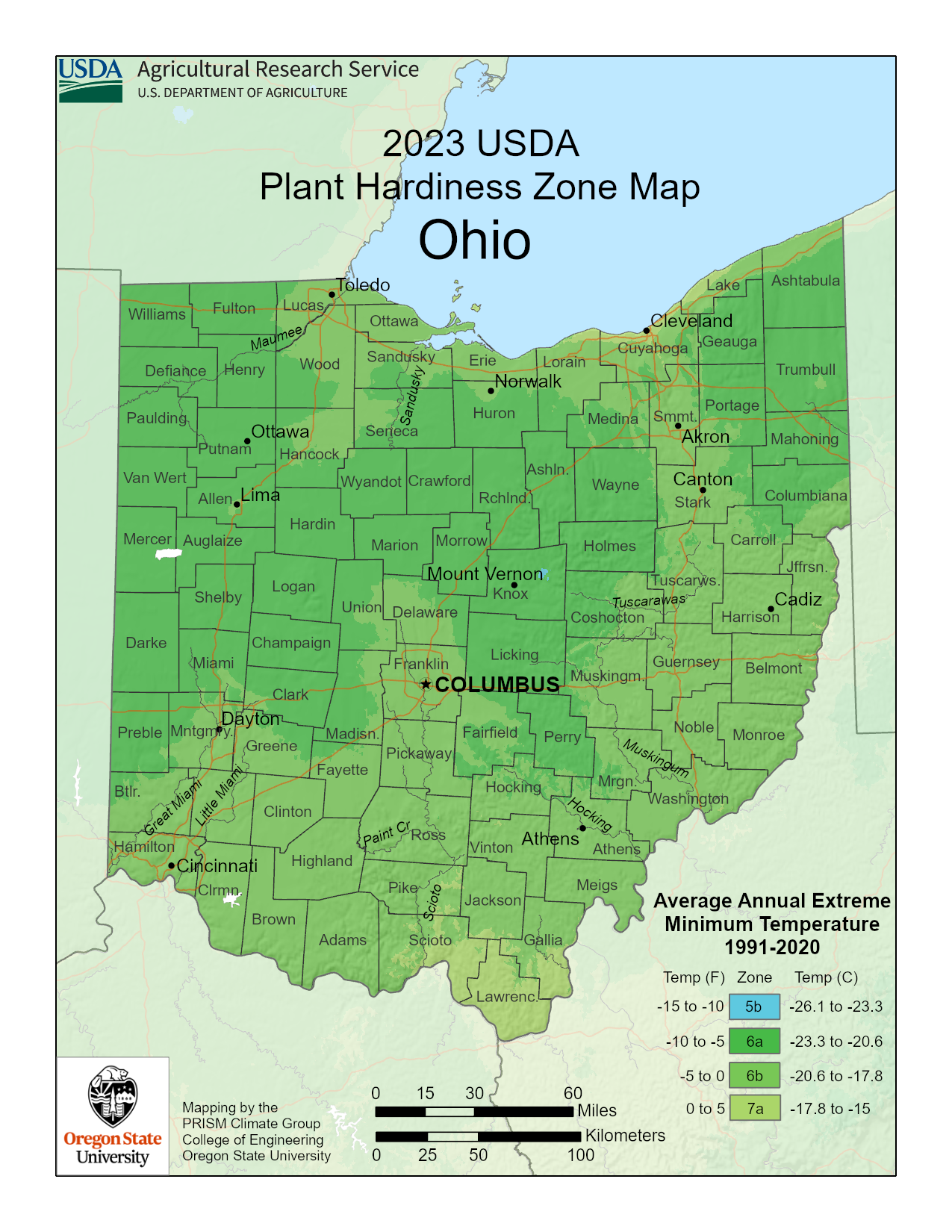
Ohio gardeners who want to ensure their perennial flowers, shrubs and trees survive all season should use the Ohio planting map, featured above, as a resource. This map divides the United States into hardiness zones based on weather data collected over the last thirty years by the USDA.
The latest map, released at the end of 2023, is more detailed and sophisticated than the previous version.
This new version takes into account the general winter warming trend and other factors, such as proximity to a large body of water and elevation. When you click on the Ohio plant map above, you can easily locate your planting zone.
Ohio does not have a whole lot of winter weather extreme variation and is divided into three subzones, 5b, 6a, 6b and 7a.
There are a number of plants, shrubs and trees that will survive even the coldest average winter extreme temperature of -15 degrees F. found in this state.
Although most local greenhouses and plant distributors will carry plants native for your region, it is always a good idea to check the planting zone before you purchase anything for your garden or landscape.
Always follow planting and care instructions carefully.