Click on the image above to see a larger version.
Understanding the Oklahoma USDA Planting Map
While there are many factors that determine how well plants do, in particular parts of the country, the USDA has been issuing a plant hardiness map since 1960 that has come to play a major factor in this determination.
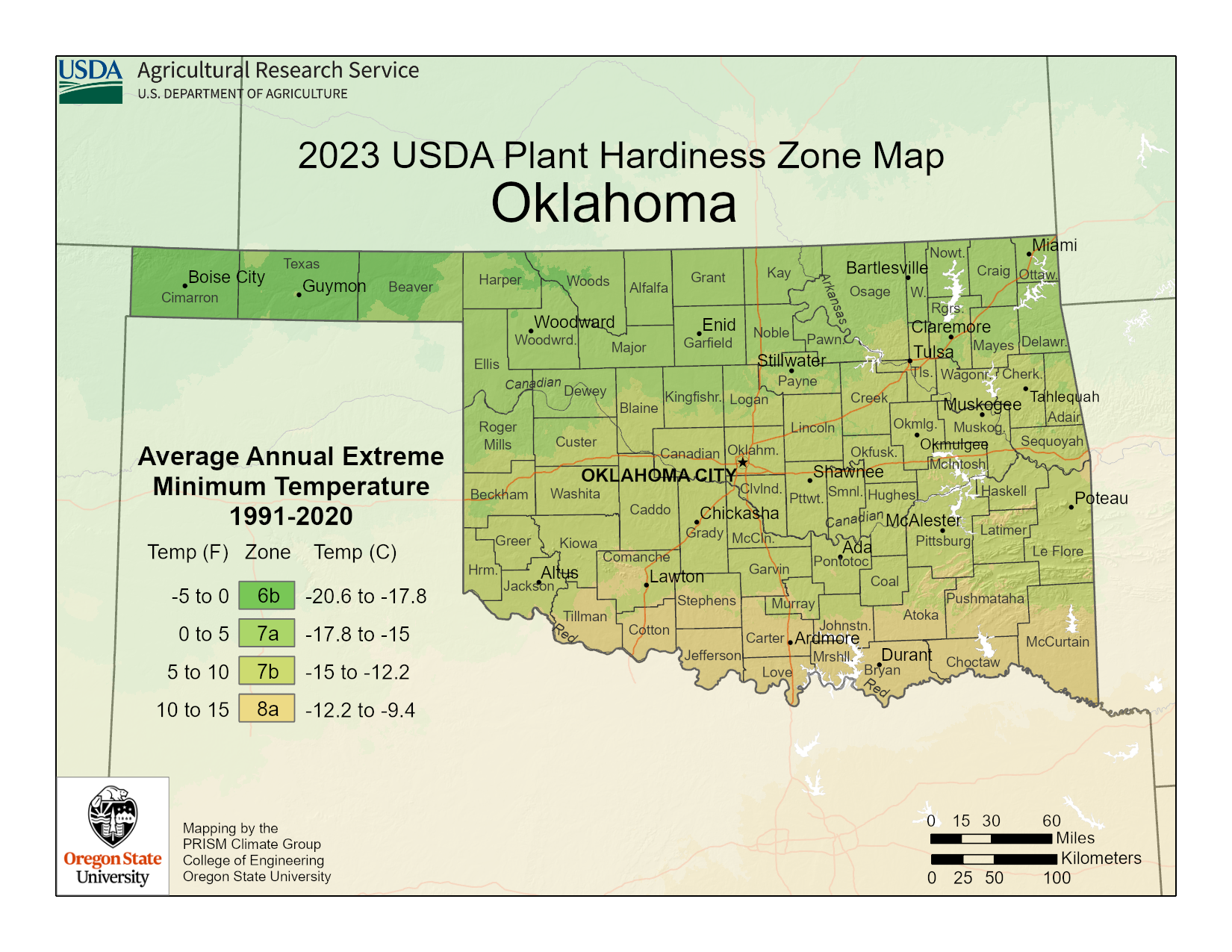
The planting map divides the country into hardiness zones based on average extreme winter low temperature data collected over a period.
The Oklahoma planting map is featured above and you can click on it to enlarge it and locate your growing zone. The state is divided into zones according to 10-degree increments.
Oklahoma includes zones 6b, 7a, 7b and a small pocket of 8a in the southeastern part of the state. Knowing which zone you reside in is useful information for both novice and experienced gardeners. Although the plant hardiness information presented in the newer 2023 USDA map is not foolproof, it does offer gardeners a great resource.
It is important to keep in mind that other factors also influence the success rate of certain plants in a particular area. These factors include, but are not limited too, humidity, winter sun, wind and microclimates that create warmer pockets.
However, it is always wise to stick to plants that are labeled “safe” for your particular zone and use the Oklahoma plant map as your guide.