Click on the image above to see a larger version.
Gardening in Oregon - Flower, Shrub and Tree Planting with the USDA Plant Map
Gardeners, especially those new to the hobby, want nothing more than to see their flowers, shrubs, and trees thrive. Sometimes choosing plants can be overwhelming, as there are some many varieties from which to select. While many factors come into play when considering the suitability of a particular plant, the Oregon USDA plant hardiness information should always be considered first.
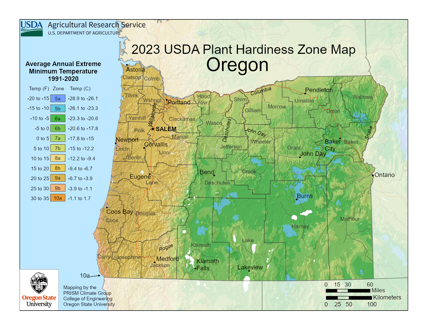
Above is the new USDA plant hardiness map, which was released at the end of 2023. The new map divides the country into growing zones based on 10-degree F. intervals according to weather data collected over a thirty-year period. This weather data recorded the average extreme winter low temperatures for the country.
Oregon zones are expansive and include zones 5a through 10a. The southern coastal region is the warmest and winter extreme lows are 30 degrees F. (-1 C.), while the coolest regions in the state may dip to -20 degrees F. (-7 C.).
To find which Oregon zone you are in, you can enlarge the map above. If you want detailed information or cannot find your location on the map, you can visit the USDA site where you can input your zip code to find your zone.