Click on the image above to see a larger version.
Learn About USDA Maryland Planting Map
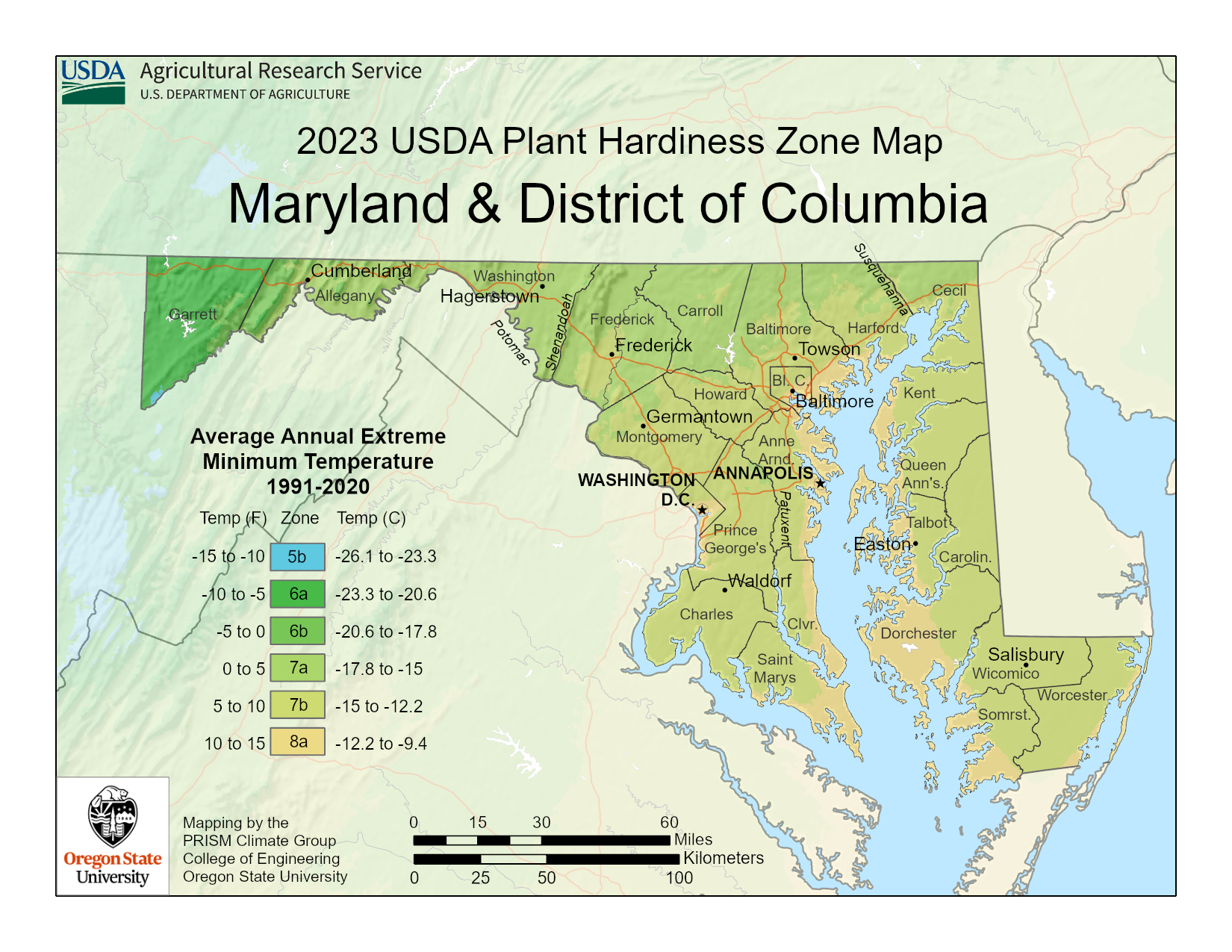
Farmers and gardeners who wish to determine winter plant hardiness for particular crops and plants use the USDA plant hardiness zone map. The map considers average annual extreme winter temperature data over a 30-year period to create growing zones in 10-degree F. increments.
The USDA released a new map for 2023, which takes into account changes in winter low temperatures over the last 30 years. New data indicates a general warming trend in winter temperatures, which has resulted in some changes in zone categorization. The USDA plant hardiness zones are to be used as a general guideline for planting.

Gardeners should be aware that there are other factors that will affect the hardiness of a plant which includes wind, soil type, humidity, snow moisture and how plants are incorporated into a landscape.
The 2023 USDA Maryland plant map includes zones 5b, 6a, 6b, 7a, 7b, and 8a. The easiest way to use the map is to click on the above map, enlarge it, and find your general area. Both novice and experienced gardeners benefit from the information provided in the USDA plant hardiness map. The majority of nurseries and plant distributors use USDA zone information on their plant labels.
If your Maryland zone is included on the label, you can be confident that the plant will survive the winter in your area, assuming that you follow planting and care instructions specific to the particular plant.