Click on the image above to see a larger version.
Information On Maine Hardiness Zones
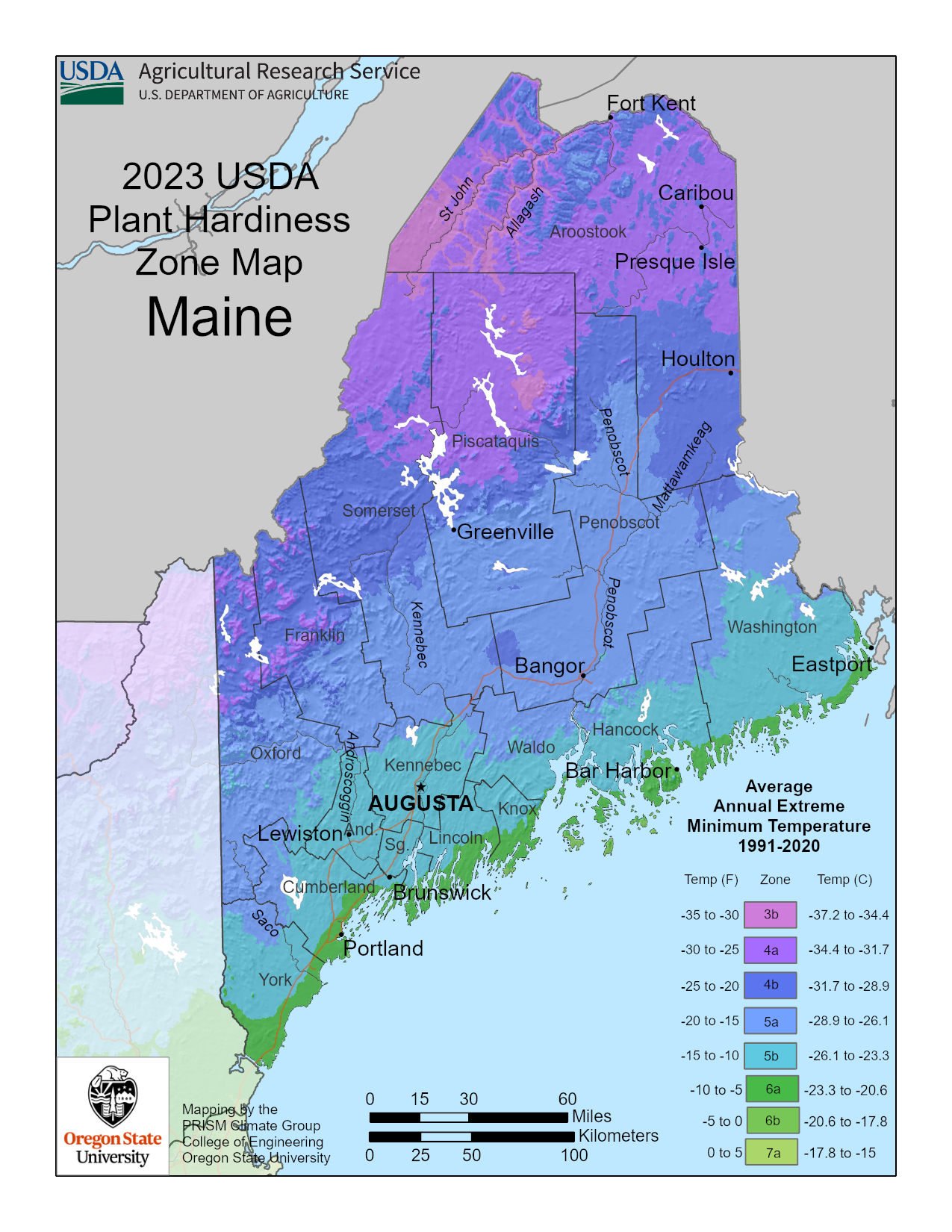
The map on this page is the USDA map of planting zones for Maine. This map will help you to find your USDA Maine hardiness zone. If you live in Maine, you live in one of these hardiness zones. To use this USDA Maine hardiness zone map, all you need to do is find where you live on the map and match the color of that area of that map to the colors on the legend to the right. This will tell you what planting zone in Maine you live in.
The USDA Maine map above is based on the updated 2023 version of the USDA hardiness map. The USDA decided to update their hardiness zone map in 2023 to better reflect the changes in climate that had occurred over the past several decades. The USDA had found that previously identified hardiness zones in Maine had shifted. This map shows where the new growing zones in Maine are. Understanding what USDA Maine planting zone you live in is important to how well your garden will do. Knowing your zone allows you to choose plants that will survive the winter. If you try to grow plants that are not appropriate to your zone, the plants you grow will die. Plants that are appropriate ones for the Maine hardiness zone you live in can be found at your local plant nurseries or stores. The perennials they carry will be clearly marked with the zone that they are suitable for. You can plant any perennial that is marked for your growing zone or lower.
