Understanding the Washington USDA Planting Map
The coastal regions of Washington State enjoy a very temperate climate with average extreme winter lows of 20 degrees F. (-7 C.).
The central and easterly portion of the state, however, could dip down to as low as -30 degrees F. (-34 C.).
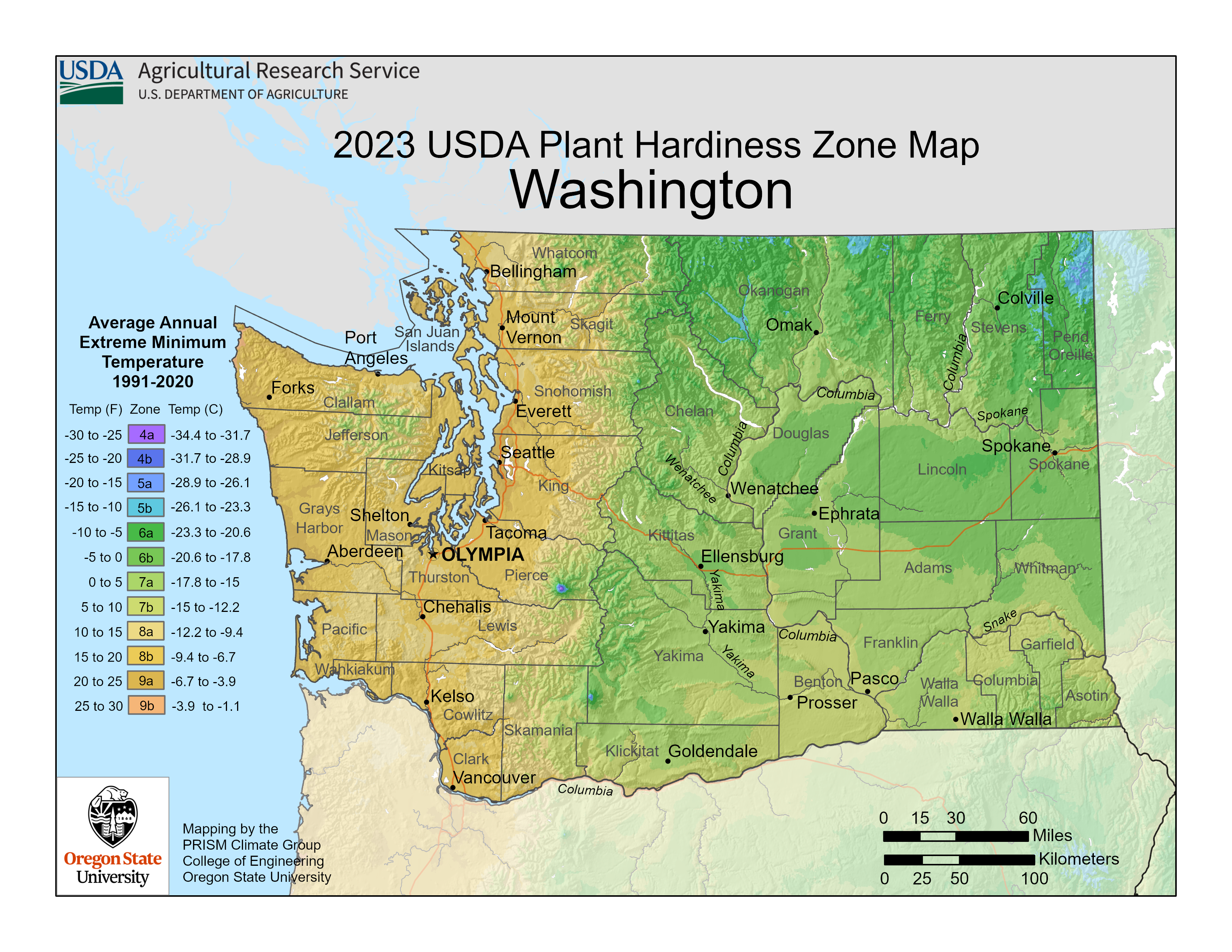
Click on the image above to see a larger version.

For the past thirty years, the USDA has collected data from weather stations around the country to use for zone determination on their new 2023 plant hardiness map. Above is the Washington planting map that you can enlarge to find your zone.
If you have difficulty finding your exact location on the map, you can visit the USDA site where you can use the new zip code zone finder feature. Knowing where you are on the Washington plant map is great information to have when you are planning a new garden or just adding to your existing landscape.
When you use plants appropriate for your growing zone, it is not an absolute guarantee that they will be successful, but it is an excellent place to start. Experienced gardeners know that there are other factors at play when deciding on which plants to use including soil type, humidity, and the effect of microclimates. Start with plants that are recommended for your growing zone, then research other factors that may have an influence on your plants as well.
Local greenhouses and nurseries carry native species that are suitable for your growing region.
In addition to choosing plants that will survive the winter in your area, be sure to follow the planting and care instructions carefully to ensure a healthy garden.